Return to Doug's archaeology page
AUSTRONESIAN MIGRATION ROUTES
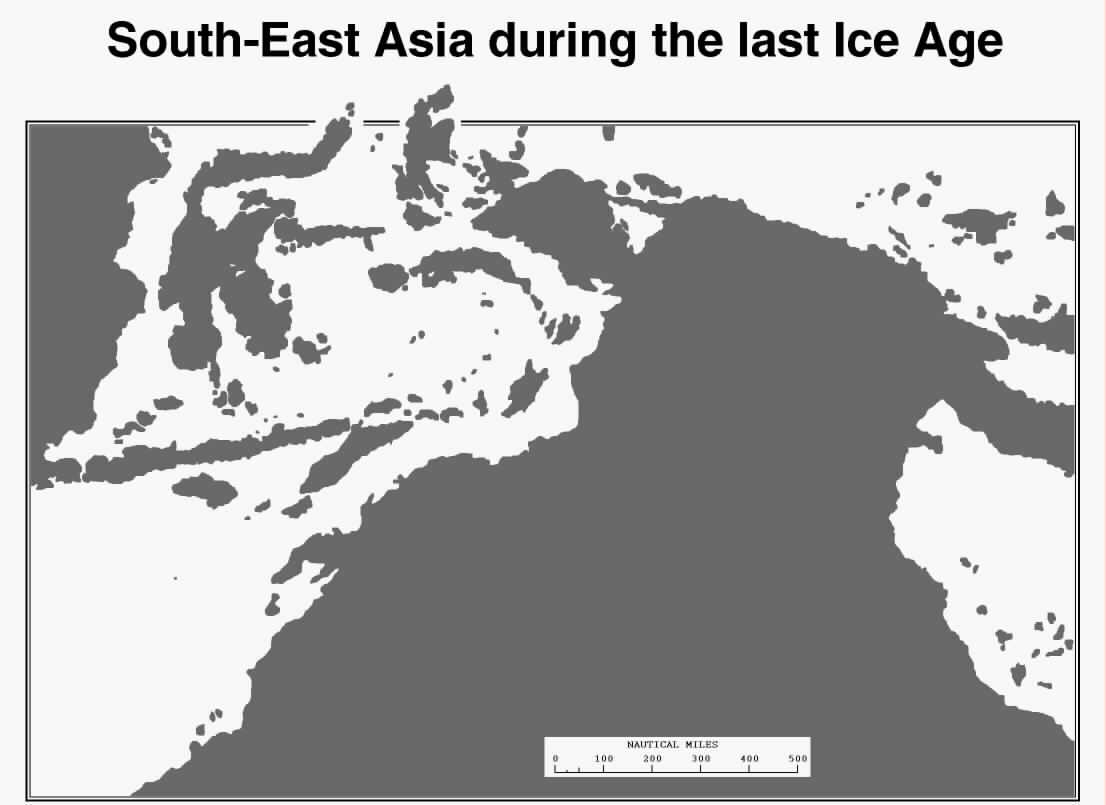
The 'Ice Age' map shows that whether early Austronesians migrated through the
Borneo-Sulawesi-Halmahera-Iran Jaya-New Guinea route or along the
Java-Timor route to Sahul their travels entailed nothing more ambitious
than island-hopping with no water 'barrier' exceeding the capabilities of
the most basic dugouts or rafts and requiring no navigational expertise.
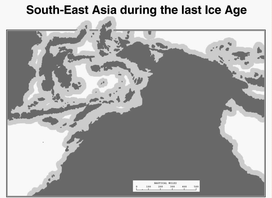
The 'Visibility Range' map (with the grey buffer zones) shows that all islands
in this region were
within sight or detection range of each other (with the exception of the
low coral islets situated in the centre of the Banda Sea which are, in any
case not on any migration route, and may indeed have not existed at this
time). While some islands might not be *directly* visible from adjacent
islands both would have been visible (or detectable) from mid-journey.
Ref. David Lewis, 1972. 'We, the Navigators'.
The early date of migrations into Sahul (and near-Polynesia) is a sure
indication that this Asia-Sahul step was one of comparative ease for
proto-Austronesians.
Robin E. Stobbs
1 Grant Street, Grahamstown, South Africa 6139
Tel: Fax:
E-mail:

Return to Doug's archaeology page